
Explore Adventures
Pick your Favorite Adventure or if you have an adventure in mind we can create a custom adventure to the place of your dreams. We might already have it in our plans or may have been there already. Email us your idea and we will get back to with you as soon as possible.

One of the most iconic trails The Rubicon Trail
Tops Off Adventures will take you on this iconic trail so you can just enjoy the views and challenge your off-road driving skills. We have very experienced guides to lead you through the trail and get some fun pictures and videos along the way. All you need to do is bring your tent, sleeping bag and something comfortable to sleep on. At Tops Off Adventures we do have clean, new sleeping bags, tents and sleep pads available upon request. We will have our chef create some wonderful meals and refreshing beverages too. Our goal is for you to have a first class experience on the trail and in camp. You will be a VIP on this adventure.
We have covered on the trail with fridges in our guide Jeeps but you are welcome to bring your own or a cooler. We will provide plenty of snacks, water and beverages to chose from on the adventure. There are portable restrooms along the trail but there are no showers. However, there are some great lakes and rivers to swim in to clean up if you chose.
If you are new to off-road or very experienced you will enjoy this adventure. Please remember there are no accommodations or facilities on this trail, once you have started there are no shortcuts out so you are committed to the entire trail.
Our adventure is limited to 8 4x4’s to ensure everyone’s comfort and driving experience on the trail. Remember you are a VIP on this adventure. We have minimum vehicle requirements for this adventure to ensure everyone’s VIP experience on the trip. Pets are not recommend for this adventure, However if you pet usually travels with you on trips like this we ask that you respect our Pet Hold Harmless Agreement. This does not pertain to Certified Service Dogs. Please read our recommended packing list and minimum vehicle requirements, if you have further questions please contact us.
We are prepared for this trail. Our guides are certified in First Aide and have many years of off-road experience that includes trail repairs. Our guides are there to assist with spotting, driving instruction, recovery, and knowledge about the amazing area the trail traverses. Our guide Jeeps carry first aide kits, fire extinguisher’s tool, some assorted nuts and bolts, and a few common parts. Our trail leader also has a SpotX gps messenger device and satellite phone for emergency communications.
A little about the Trail
The Rubicon Trail is located in the California High Sierra, due west of Lake Tahoe. This world-renowned 4-wheel drive route leads from Georgetown, California to Lake Tahoe, California. With a total distance of approximately 22 miles. The trail is a non-maintained County road located in El Dorado and Placer Counties. Parts of the trail pass through the Eldorado National Forest and portions of private lands.
Elevations run from approximately 5400 to over 7,000 feet. The section of road from Georgetown to Wentworth Springs (also known as the McKinney-Rubicon Springs Road) is a maintained road, while the off-highway vehicle (OHV) trail begins near Loon Lake. The portion of the trail from Loon Lake to Lake Tahoe is about 12 miles long and winds through the trees and rugged granite common to the area.
The Current Trail
While the current trail travels the same route from Wentworth Springs to Rubicon Springs that has been used since the 1860s, it changes a little each season due to erosion and vehicle traffic. Many of the rock formations along the route are unique, allowing identification from historic photos of the original route which is crisscrossed in some areas by the 4-wheel drive road. The 4-wheel drive road also crosses a spillway built by PG&E in the 1930s and 1940s.
The Rubicon Trail is now widely recognized as the premiere OHV route in the United States and has been called the “crown jewel of all off highway trails.” At one time, it was revered as the most difficult, rated 10 on a scale of one to 10, due to its narrow passages, rocky climbs, and occasional mud hole. Because of its difficulty, the trail is recommended for short wheelbase vehicles with all skid plates in place.
The Rubicon Trail attracts both street legal and “green sticker” off-road motor vehicles. As a result, users travel the trail on and in wide range of all-terrain vehicles, including dirt bikes and a variety of 4-wheel drive vehicles, from street-legal SUVs to vehicles built for the sole purpose of driving the trail. Because the trail lies adjacent to the Desolation Wilderness, the Rubicon Trail is also used as an access route by hikers, backpackers, and fishers.
The ceremonial Rubicon trailhead is in Georgetown, a small community nestled on the western slopes of the Sierra Nevada Mountains in California’s old Country. The much of town’s economy is centered on servicing and supplying many Rubicon adventurers and their vehicles. The Rubicon Trail is normally run west to east. The western end of the Rubicon Trail has two trailheads. The true trailhead is located at the Wentworth Springs campground, while the more popular trailhead is at Loon Lake. These trails converge at Ellis Creek, approximately one mile from the start of each course.
The trail from the Wentworth Springs trailhead starts with an uphill climb. Once at the top, the trail levels out to a challenging drive to Ellis Creek. The trail from Loon Lake is more moderate. Beginning at the bottom of the spillway at the second dam, the trail passes through the Granite Bowl. It skirts Loon Lake on its way to Ellis Creek, where it joins with the Wentworth Springs section. From Ellis Creek, the trail winds through the trees on its way to Walker Hill.
Walker Hill is a challenging, uphill area that offers drivers a number of difficulties. This area contains three sections, each with its own challenge. First comes the lower, rock-strewn section, which makes a sharp turn to the right. Second is 100 feet of extreme trail that makes a turn to the left. Finally, you reach the third, upper section, referred to by some as the “sandstone section,” which is difficult terrain over decomposing rock. At the top of Walker Hill is a wide spot in the trail in a small grove of heavy timber. From here, the trail continues on toward the Little Sluice.
The Little Sluice is challenging and considered by many as the most difficult part of the Rubicon Trail. Though only about 100 feet (30 meters) long, it is heavily boulder-infested. Once through the Little Sluice, most drivers take a rest near Spider Lake. A high mountain lake just above a low hill on the south side of the trail. From the Little Sluice and Spider Lake, the trail continues for approximately a mile to a granite shelf overlooking the Rubicon Valley and Buck Island Reservoir. At this point, the trail forks to the Granite Slab on the left and the Old Sluice on the right.
The Granite Slab route is more scenic and less time-consuming. It makes its way to the right and down the granite face of the mountainside, rejoining the Old Sluice fork approximately half a mile before the Buck Island Reservoir.
The Old Sluice route is more difficult, following a section of the historic Rubicon Trail that is often bypassed due to its difficulty. The route is fairly level along the mountainside, first reaching the short Chappie Rock drop-off. From here, the trail continues on its level path until reaching another small overlook. From this overlook, the trail begins a gentle, then steep, descent into the Old Sluice.
The Granite Slab and Old Sluice routes rejoin just past the bottom of the Old Sluice. From here, the trail crosses over the dam at Buck Island Reservoir. The trail then skirts the eastern edge of the reservoir and bears left, up, and over a low mountain pass before heading down to the Big Sluice.
The Big Sluice is another challenging section of the Rubicon Trail. Though misnamed (the Big Sluice traverses the side of the mountain rather than being walled on each side), this long downhill section offers rock after rock to crawl over.
After the Big Sluice, the trail crosses a bridge over the Rubicon River and heads down the Rubicon Valley. It passes through Rubicon Springs, continues on past the El Dorado County boundary line, and enters Placer County.
In 2009, El Dorado County with the assistance of California State Parks, Off-Highway Motor Vehicle Division Grant program implemented maintenance activities on the Rubicon Trail. The trail has also been surveyed and the trail location was adopted by the Board of Supervisors on January 26, 2010. El Dorado County, along with Rubicon Trail Foundation has developed trail markers, maps and educational materials to inform the public of the trail location. Law enforcement on the trail has increased in recent years to enforce all rules of the road.

Go Topless Day Chama, New Mexico Adventure
The Cumbres and Toltec Jeep Trail is one of those epic adventures in New Mexico. The trail at times crosses the tracks of the narrow gage train and sometimes follows the tracks. This is usually a ten hour trail ride with a stop for lunch. It is a long trail that constantly changes and with areas of snow pack to traverse.
The off-road trail takes you through steep mountain canyons, high desert, and lush meadows as you zig zag between the Colorado and New Mexico border. Open your eyes to spectacular and rare Western scenery which can only be viewed from this unique route.
The trail crossed Cumbres Pass that crossed the Rocky Mountains since 1880 with the first railroad tracks. Visit the historic San Antonito Train Station and cross the Rio Chama River.
The Rio Chama is a major tributary of the Rio Grande in northern New Mexico. It flows through a multi-colored sandstone canyon which is, at times, 1,500 feet deep and through a wilderness and wilderness study area. Towering cliffs, heavily wooded side canyons and historical sites offer an outstanding wild river backdrop for the hiker, fisherman, or boater.
Cultural
Northern New Mexico, and the Rio Chama Valley in particular, are known as some of the richest regions for archeology studies in the U.S. For more than three centuries—about A.D. 1250 to 1577 —this spectacular locale was home for over 1500 Pueblo Indians who built villages, dwelled, farmed and hunted game here.
Ecologic
Trout often flourish in the river, and onshore residents include mule deer, black bears, elk, coyotes and mountain lions. Varying canyon elevations also provide a wide range of vegetation, from low-lying pinion-juniper woodland to ponderosa pine and fir. Between 70 and 80 different bird varieties can be found in the Chama River Canyon. Raptors, hawks and owls perch along the canyon walls and surrounding trees.
Geologic
The Rio Chama carved a 900-foot-deep canyon of colorful siltstone, gypsum and sandstone layers. Floating down the river provides an ever changing view of sedimentary layers traveling back in time millions of years. There are even the imprints of dinosaur tracks preserved in one side canyon..
Scenic
The Rio Chama creates a canyon of colorful siltstone and sandstone surrounded by gently rolling sagebrush-covered plains. Piñon woodlands cover the hills, and forests of ponderosa pine and Douglas fir cover the north facing slopes.
Planning is in the works for 2022 Adventure.

Moab, Utah Adventure
Moab, Utah the Jeep and off-road mecca of the United States. There are over 80 trails in the area. from easy to very challenging. There are numerous Jeep Badge of Honor Trails too. There are plenty of places to get that fun picture of your Jeep such as Top of the World, one of the more famous picture locations for a Jeep.
Moab Weather is usually good the best times are spring and fall, it can get hot in the summer. As always be prepared for anything from rain to snow and wind. We do a spring and fall Moab Adventure. The adventure is typically 3 days on the trails. We will guide you through some of the best trail in the area. We may also try to get out for an hour or two and see the moon above the Colorado River from The Hells Revenge Trail.
For colossal adventure and geographical drama of Jurassic proportions, head to Moab in Southeast Utah.
When in Moab, you may want to visit one or both of the National Parks. If you’re going to Arches National Park, you’re going to Moab Utah. If you’re going to Canyonlands National Park, and you’re not hiding out from the authorities in some desolate corner of the Maze, you’re probably staying in Moab. The weird grandeur of these two federal designations is documented elsewhere — just know that you need to see them both in person, twice, before you die. Dead Horse Point, too.
Our 2021 Adventures plans are in the works. We will have the plans finalized in early 2021. Feel free to contact us if you would like to be notified when we post the events. info@topsoff.net
Chloride Canyon, New Mexico Adventure
Chloride Canyon trail is one of our favorite adventure trails in the state of New Mexico. It usually is not a difficult trail but is rocky in areas with some steep hill climbs, and downgrades. If there is snow it can be a challenge to climb the mountain. If it rains be aware for flash flooding. However, it is is wet when you are on the trail there are over 138 water crossings in the canyon. There is so much to see on the trail. There are petroglyphs in the canyon, there are multiple places to primitive camp, there is a camp site with a restroom about 3/4 of the way through the trail. Then on the way out you can take the turn off and go 8 miles up the mountain to a forest fire tower with phenomenal views of the canyon and beyond.
This trail starts out in the historic town of Chloride, New Mexico and travels through the canyon for 29 miles, with an additional 8 miles to the Fire Tower. the trail has about 4,400ft. of elevation change. Usually a stock Jeep or 4x4 can traverse this trail without difficulty. It is important to check the weather in the area. You will actually go over the continental divide.
If you enjoy history of the United States, this is the adventure for you. There are plenty of things to see and learn about the area, the people and the towns.
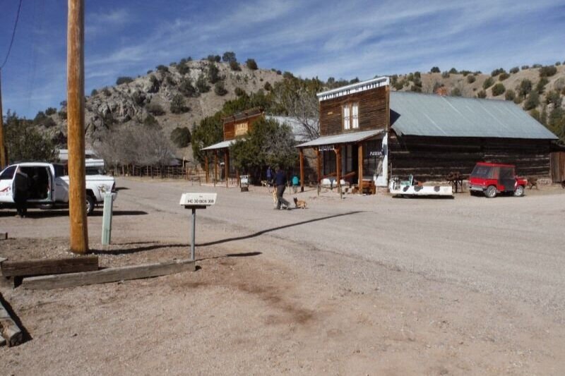
This adventures leaves from Truth or Consequences, New Mexico traveling on pavement for about 38 miles. You will pass by some of Ted Turners Range land and climb a hill (known as cell phone hill) one of the few places with cell coverage. Then you drive down into the town of Winston, New Mexico. (first called Fairview) was settled in 1881 by miners who found nearby Chloride “too rowdy.” This a a great place to stop at the Winston General Store for some snacks and possible some great antique dishes. There is only 1 gas pump at the store. The drive continues for a few miles where you then arrive in the town of Chloride, New Mexico was founded in 1880 it was a silver mining town in the day and now home to 11 residents. Today, many of Chloride’s original structures still stand. The old Pioneer Store is a museum; next door the former Monte Cristo Saloon and Dance Hall houses a gift shop and gallery featuring work by local artists. We usually get a tour by one of the residents of the town and old Pioneer Store. Then it’s time to air down the tires and get on the trail that is just feet from the historic buildings still standing in Chloride. On the trail to enjoy the views and some water crossings, a stop to see some of the petroglyphs. then usually a stop at the camp for lunch, then continue on the trail enjoying the views all the way. Once on the way out it’s time to take the side trail 8 miles up the mountain to the Fire Tower and enjoy some more great views. Lastly, down the mountain and back out to pavement. This trail is sort of a large loop so you end up just north of Winston, New Mexico and then pavement back to Truth or Consequences, New Mexico for a group dinner at one of the best restaurants in the area Los Arcos Steak and Lobster.

Sedona, Arizona
Welcome to Red Rock Country
START WITH SCENERY THAT MAKES YOUR HEART LEAP. SEDONA NESTLES AMONG A GEOLOGICAL WONDERLAND.
Our 2021 Adventures plans are in the works. We will have the plans finalized in early 2021. Feel free to contact us if you would like to be notified when we post the events. info@topsoff.net

Silverton, Colorado area
The town of Silverton is a Statutory Town that is the county seat of, and the only incorporated municipality in, San Juan County, Colorado, United States.[8] Silverton is a former silver mining camp, most of which is now included in a federally designated National Historic Landmark District, the Silverton Historic District. The town population reached 637 in the U.S. Census 2010.[9]
History of Silverton
Silverton is linked to Durango by the Durango and Silverton Narrow Gauge Railroad, a National Historic Landmark. Silverton no longer has active mining, but subsists by tourism, maintenance of US 550 (which links Montrose with Durango via Silverton), mine pollution remediation, and retirees. In 2002 an extreme ski mountain, Silverton Mountain, opened near the town.[10]
Charles Baker's group of prospectors found traces of placer gold in the San Juan Mountains in 1860 at Eureka, Colorado. Forced out by the Ute Tribe in 1861, who had been awarded the area in a US treaty. The prospectors returned in 1871, when lode gold was found in the Little Giant vein at Arrastre Gulch. The miners were allowed to stay after the Brunot Treaty of 13 September 1873. In exchange for giving up four million acres (6,200 sq mi; 16,000 km2), the Southern Ute Indian Reservation received $25,000 per year (or about $534,000 per year today, adjusted for inflation).[14]:49
In August 1873, George Howard and R. J. McNutt discovered the Sunnyside silver vein along Hurricane Peak. Gold was then discovered in 1882. The Sunnyside Mine was shut down after the 1929 stock market crash, but was acquired by Standard Metals Corp. in 1959, and reopened, finding gold in 1973 with the Little Mary vein. Half of Colorado's gold production in the 1970s came from the Sunnyside. Disaster occurred on 4 June 1978, when the water from Lake Emma collapsed a mine shaft (when miners weren't present), and then traveled quickly through the tunnels, finally shooting out of a portal along Cement Creek with a force that toppled a 20-ton locomotive.[15] The mine reopened after two years, but was acquired by Echo Bay Mines in 1986, which operated the mine for another five years.[14]:50–51,60,123[16] The nearby Gold King mine breached and spilled into Cement Creek, causing the 2015 Gold King Mine waste water spill.
In the early 1960s Kendall Mountain Ski Area opened by the Grand Imperial Hotel.
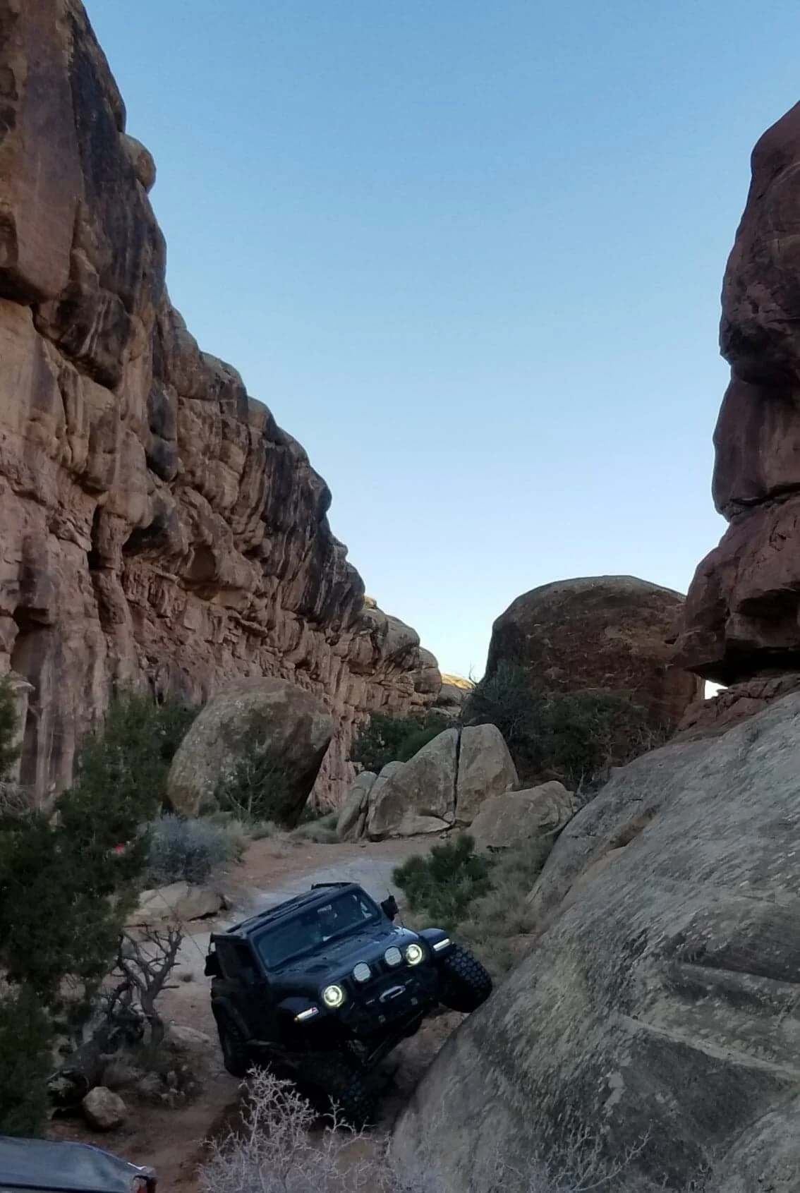
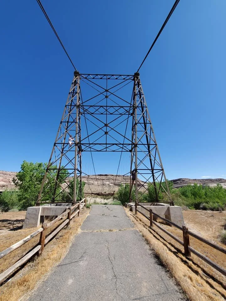
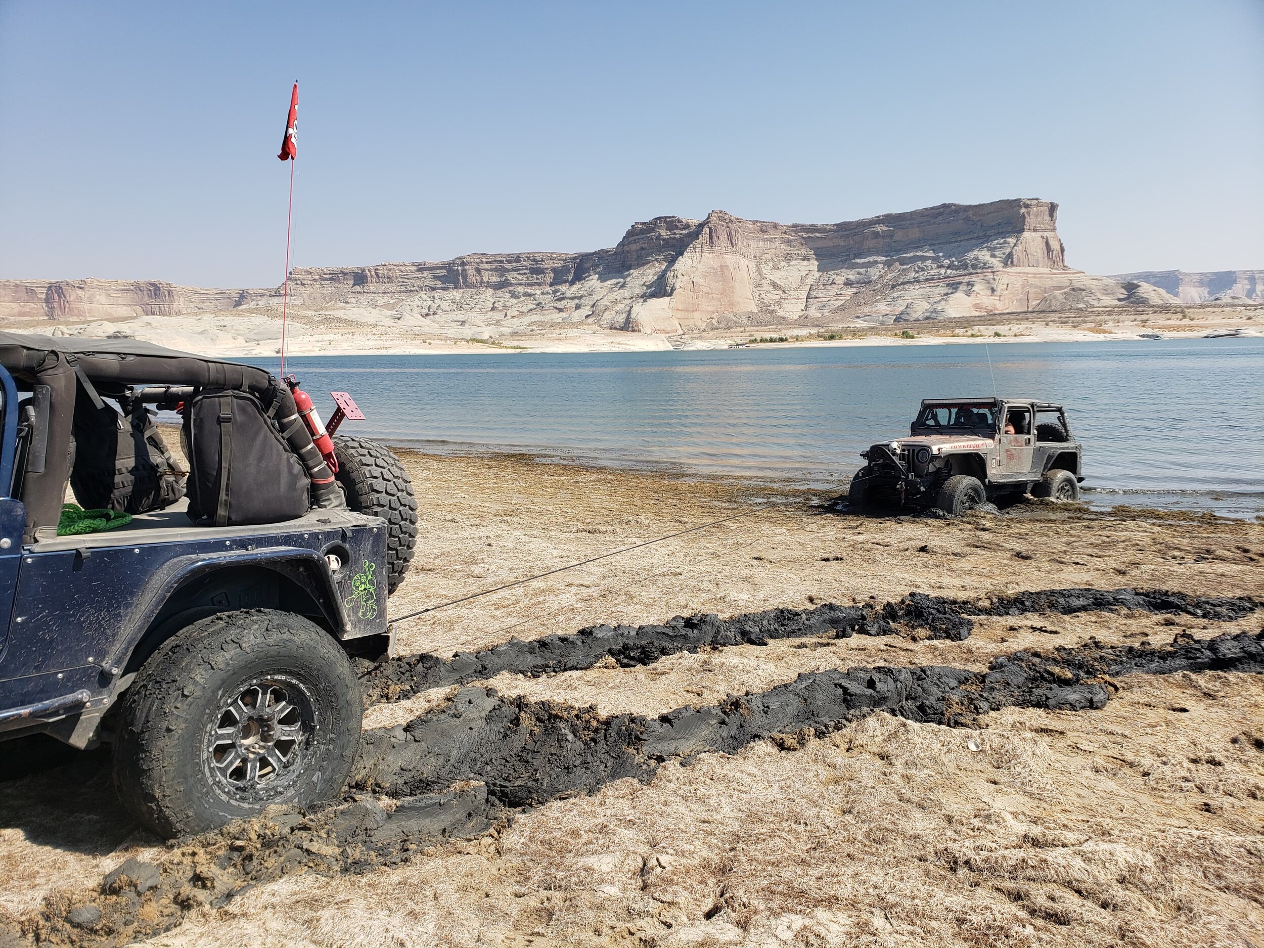
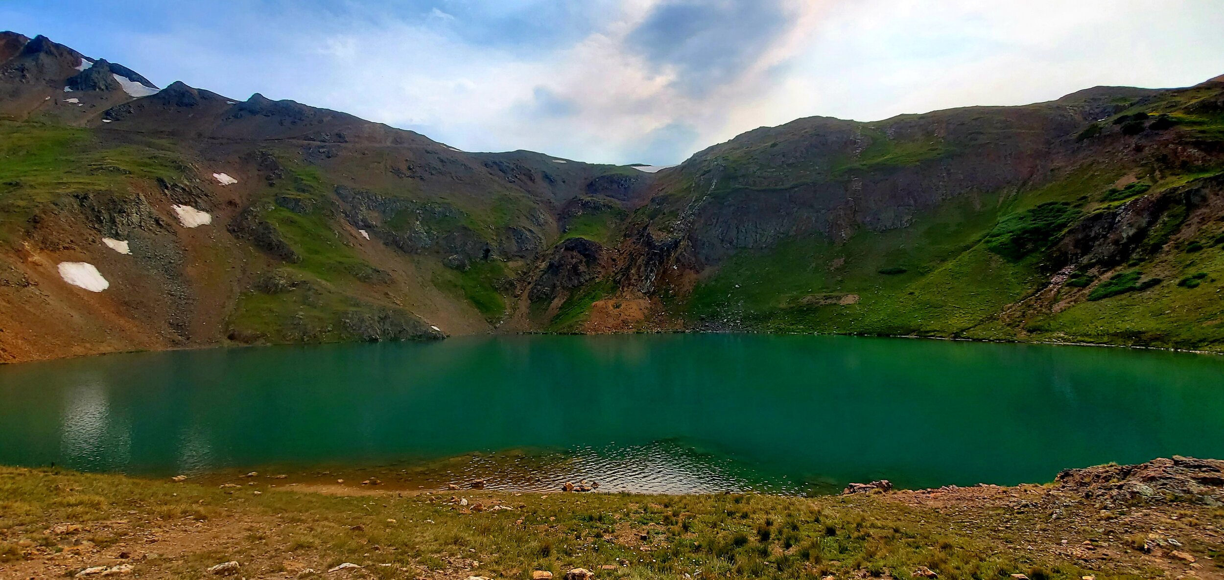
Pictures From our Adventures